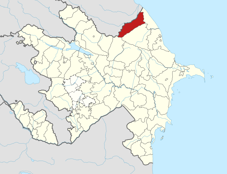
Kuzun-Laza Hiking Route
In this article I will inform you about one of the beautiful hiking routes in Azerbaijan. It lies in between two ancient and gorgeous villages of Gusar region, Kuzun and Laza. Gusar region itself is part of the Greater Caucasus. Like in many other parts of Azerbaijan, here also people of different minorities live among which lazgi ethnicity prevail. Therefore, when you visit these villages and remote settlements you will more likely here people speaking in a different language with family members. This is what we consider the richness of Azerbaijani society. A country with different ethnicities who live peacefully together. Total population of Gusar is estimated to be 100 thousand, of which 80 percent are Lazgins. Remaining population are Azerbaijani, Russian and others. Gusar region is situated in the north of Azerbaijan very close to the Caspian Sea but without access. It is a mountainous region with peaks above 3000m. and fast flowing rivers.
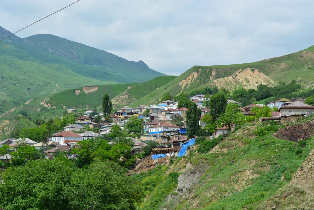
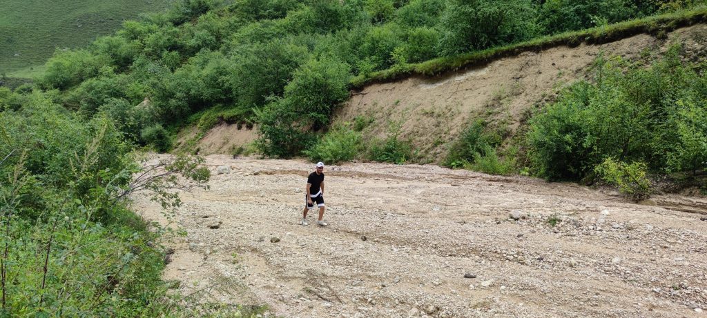
We arrive in Kuzun village first from where we start our hiking. Kuzun is located 1280 m above sea level. The majority of people are Lazgins with around 900 population in the village. Gusarchay river flows through the village and there is a small bridge over the river. The village road closer to the village is often destroyed by river floods in rainy periods of season. But the road is repaired quickly by the government agencies.
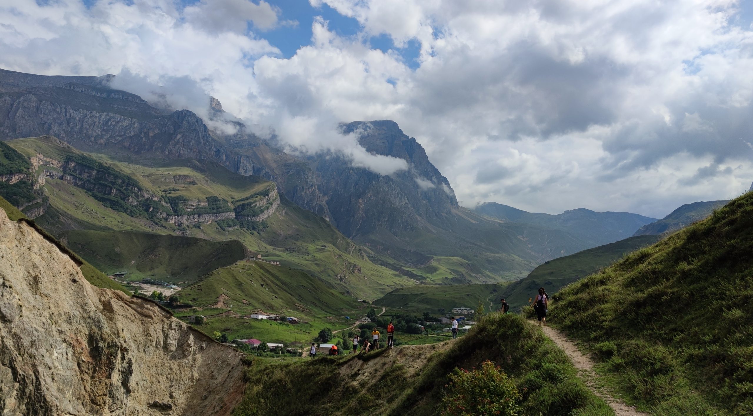
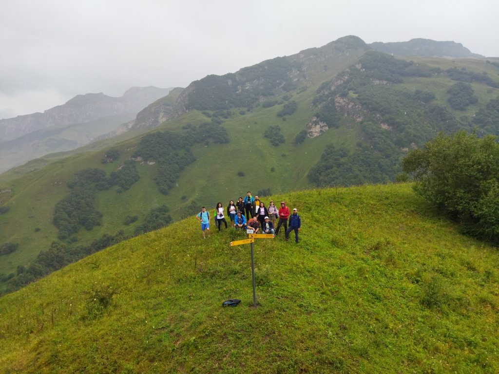
After getting prepared and packing up our stuff we start our walking by ascending the nearby hill overlooking the village. It should be noted that this hiking route is somewhat parallel to the road over a mountain on our left which takes to Shahdag skiing complex and then to the Laza village. Traditional tourism companies usually take people to these places by car whereas we use the route through nature. Like in the world, here in Azerbaijan also we use the path for hiking that villagers use for transport to nearby villages and for cattle grazing. Regardless of having several paths we choose the one that allows us to take more altitude in the beginning, rather than ascending and losing altitude several times. We get to cross over a small riverbed once, which is easy to pass only with some difficulty in rainy weather as it becomes slippery. Then we continue with some plain part with gradual ascending to the hill. Let me tell you that in general we have three main ascending parts of the route. Second hill is almost in the middle of the route and from there you can observe both sides of the route. I claim the best view is here. The last ascending on its turn, takes up to Laza village. Before getting to these parts let’s continue with our hiking. Now we are quite far away from the Kuzun village.
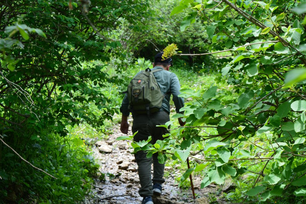
Now we enter a forest and walk through the trees. In hot weather it allows us to cool down some while in rainy weather, it is bit of a chance to hide from rain. Here we hear traditional questions about how much is left until the main stop where we have lunch. By the way you will also see some signs showing you the direction, however it is not fully enough for a stranger coming the first time without any prior hiking experience.
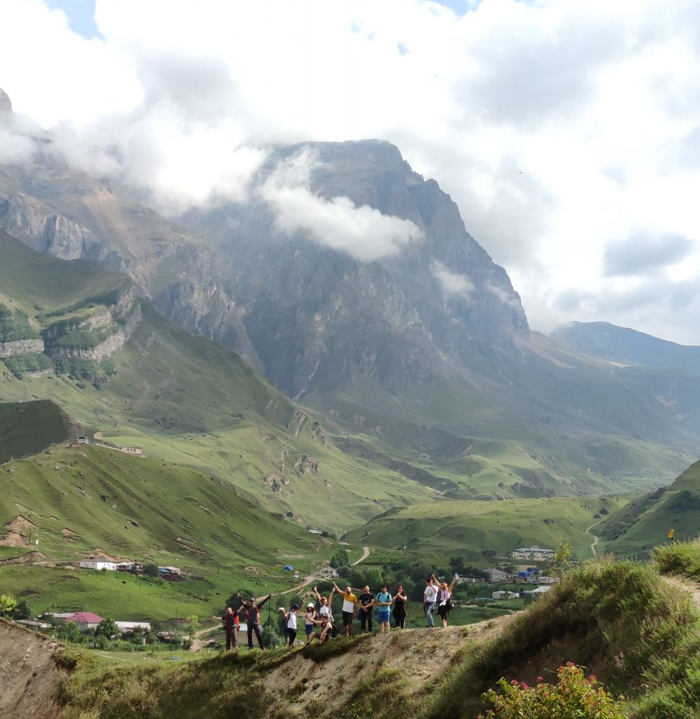
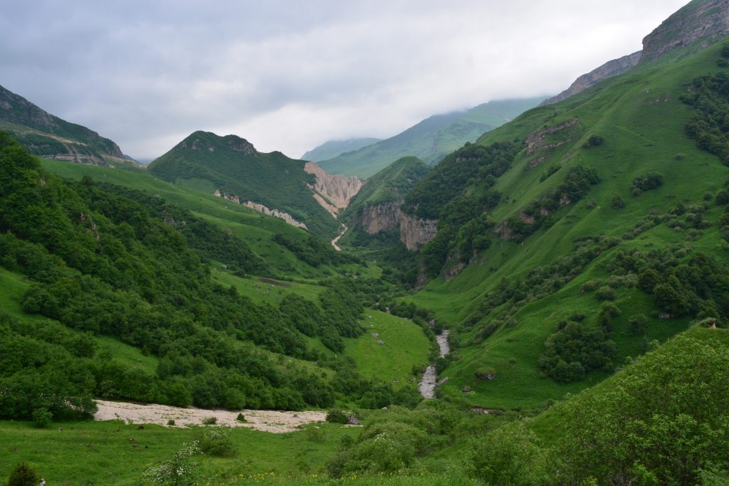
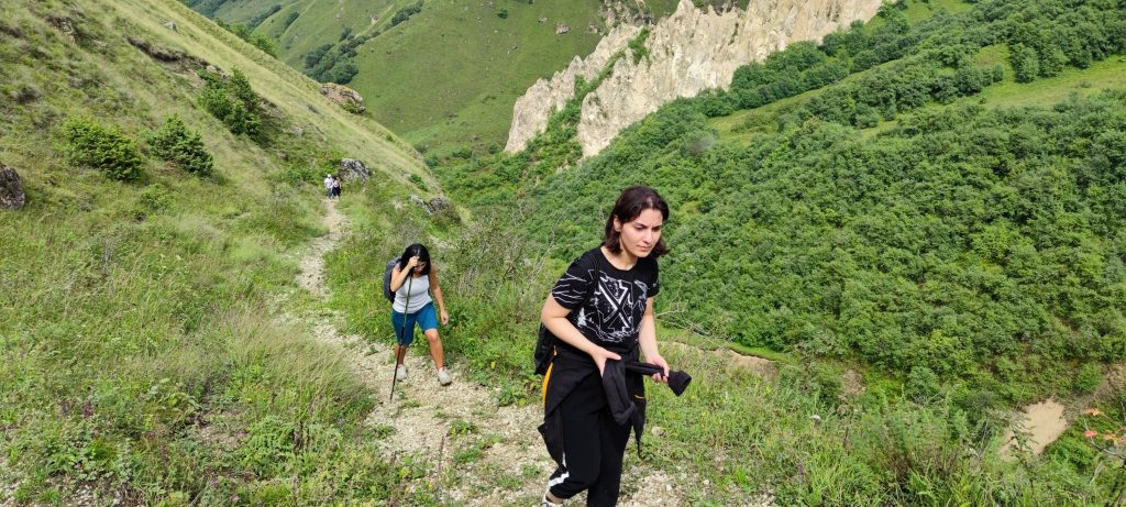
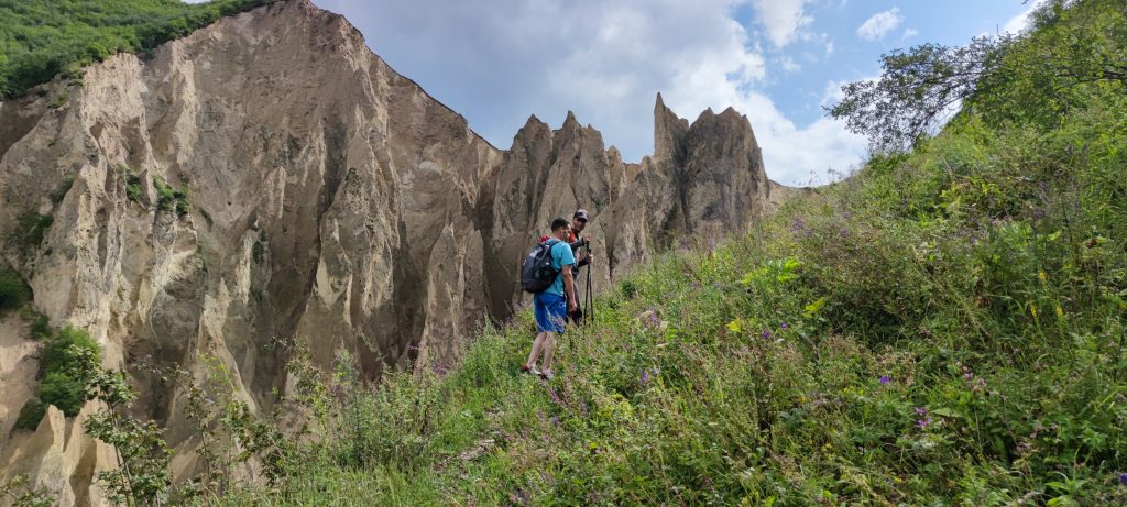
We walk up to first hill from where we have a nice view around and this is the first stop where you can take photos. Ahead of us, there is another mountain, which yet closes the view of mountains surrounding Laza village. After taking some break here we start to descend to a forest again and walk through it and come to a point which I consider the hardest part of the route. It is a path though the forest but with steep ascending with around 40 degree. This part makes can make you tired and leave you breathless. I suggest you to not hurry but use an average speed and walk upward slowly. Finishing this path and reaching the top of the hill you come to the middle of the route with the best view of the tour. Ahead of us we see Gusarchay river flowing through the valley, mountains on both sides and green forests. We also see the mountain at the end of the route and big rocky place. That is the third ascending part with many U turns which lead us to Laza village.
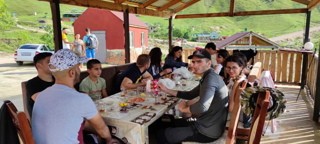
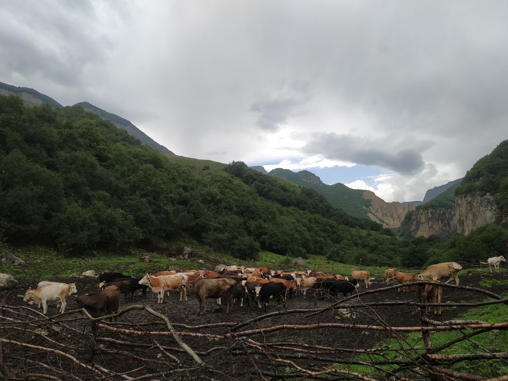
We have our lunch here and rest to get more energy. After this part until the last ascending part we descend some and then walk straightforward. Descending part maybe some slippery in rainy and snowy seasons of the year but we hikers also enjoy even if we fall down sometimes. We get down to big plain area where we approach the riverside. Only this year I saw shepherd settlement and a local villager was there with cattle. It was right on our route leaving us no way to pass but we informed them that they should leave some narrow path to pass through. Hopefully, we will not have difficulty next time when we go through this part. For this time, we just jumped over the wooden fence twice.
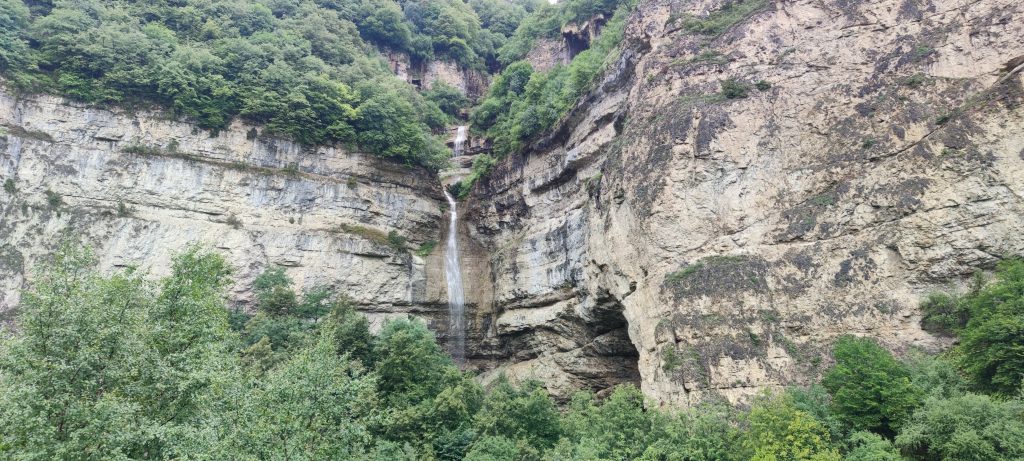
Continuing to walking we enter a short part through the forest and then again an open plain area and continue for a while with some ascending. Then we arrive in another beautiful point of the route where there is a view of waterfall on the other side of the river. There is no way to cross the river and the other side of it is a wall over which waterfall flows down.
After some nice photo shooting with waterfall we continue our way along the route. We arrive in a part of the river where we have to cross. We climb a short hill on the other side move forward. Then we go down to river bed again and continue in small rocky river bed. This takes us until the part where a path starts up to mountain. Here you will also see a sign showing the direction. This path gradually ascends but makes no serious trouble as it has got many U turns which makes walking upward easier.
We continue our way for about half an hour and finally reach the top, almost end of the route. Yet there is some 25-30 minutes till the center of the village. This part is mainly descending until the village houses.
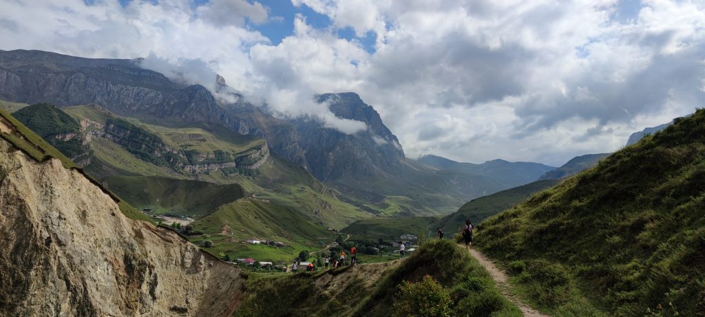
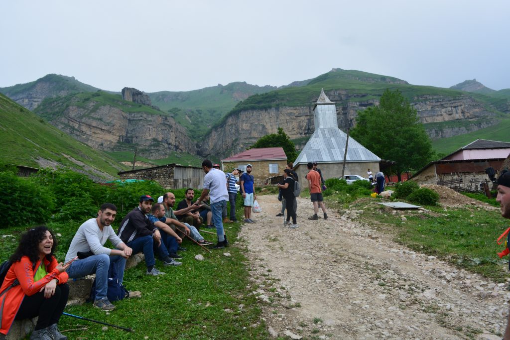
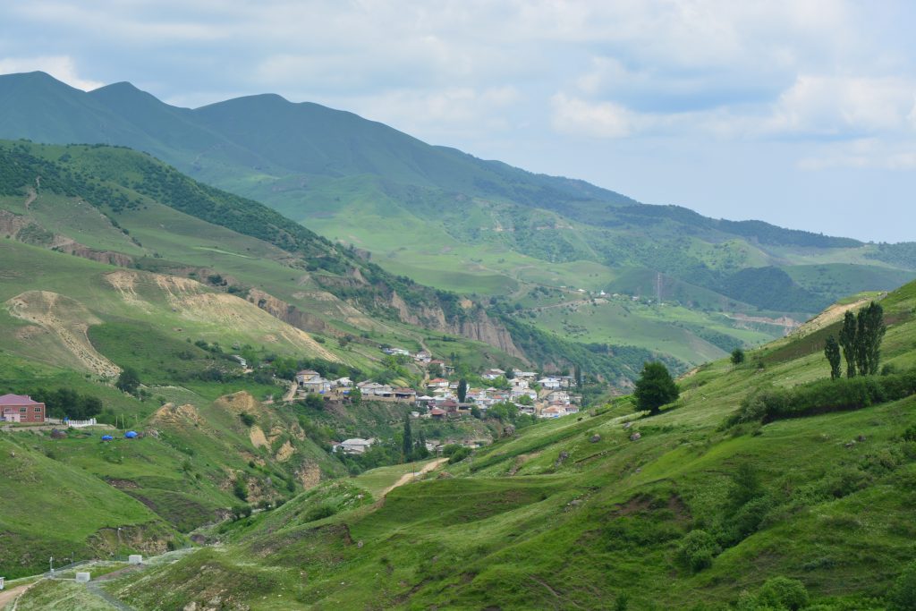
Laza is a beautiful village surrounded with mountains. It is situated 1300m above sea level. Highest point of the village is 1660m above sea level. There are tall waterfalls on these mountains. You can often see fog here because of the altitude. It is cool in summer and snowy in winter months. Many tourists visit the village in summer. Because of the rain village road often get collapsed so in winter months only offroad cars can reach the village but still you have to be careful.